

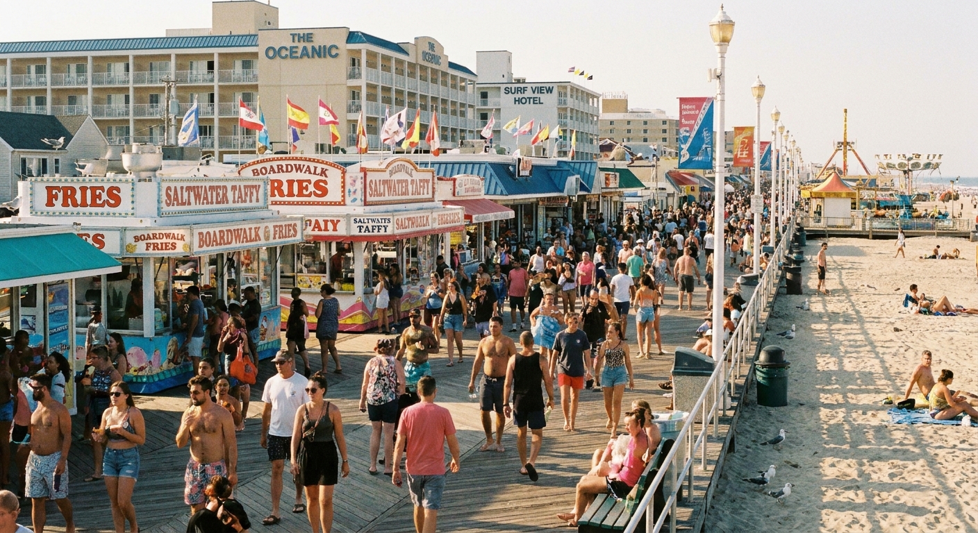
I learned this trick as a kid in a military family, when “new town” meant “new weekend mission.” If a place had a famous boardwalk, we would do it once, eat the overpriced fries, then spend the rest of our time figuring out where locals actually went when they wanted a little peace.
These days, I use ZIP code boundary maps as my shortcut. In high-traffic waterfront towns, the busiest strip can be clustered in one corner of a ZIP, while a quieter pocket sits just across a boundary line with different beach access options, different parking patterns, and a totally different vibe.
Why ZIP boundaries help
In shore towns, crowds behave predictably. Most visitors:
- Head to the best-known beach entrances near the biggest parking lots
- Cluster around the main commercial strip, piers, and boardwalk attractions
- Stay within a few blocks of their hotel or a named landmark
ZIP code boundaries can reveal where that clustering tends to fade. Not because ZIP codes create the rules, but because a ZIP map is a quick way to see where the built environment often changes.
A boundary line can be a handy proxy for where you might start seeing:
- Tourist-core blocks give way to residential streets
- Big-lot beach entrances give way to smaller walk-in access paths
- Restaurant strips give way to quieter “one or two cafés” corridors
Think of ZIP codes as a way to zoom out just enough to spot the edges of the chaos, then zoom in to confirm the details on the ground.
If you are new to using ZIP codes as your map lens, start with our Zip Code Lookup guide and then come back here with one busy coastal ZIP in mind.
The 10-minute map method
Here is my quick routine when I am staring at a high-traffic waterfront ZIP and refusing to spend my whole day in a slow-moving crowd. Depending on the town and your signal, it takes about 10 minutes.
Step 1: Outline the magnet zone
In most beach towns, the magnet zone is whatever sits within easy walking distance of the most famous entrance or promenade. On a map, that usually looks like:
- A dense cluster of businesses right along the shoreline
- Several large parking lots or garages nearby
- More hotel labels than residential street names
Mentally circle it. Your goal is not to avoid it forever. Your goal is to treat it like a quick visit, not your base camp.
Step 2: Find where the boundary runs inland
Quiet does not always mean “far from the water.” It often means “one boundary away.” Look for the spot where a ZIP boundary runs inland, bends behind the main strip, or traces a different grid. That shift is a clue the town’s layout may change nearby.
Step 3: Pick an edge access target
On the calmer side of the boundary, look for one of these targets:
- A smaller beach access path name (often a street-end access)
- A neighborhood park near the water
- A marina, inlet, bayfront, or riverwalk area that is not the main oceanfront
If you want a simple radius approach, pair this with our method in How to Plan a 5-Mile Radius Day Trip From Any ZIP Code.
Step 4: Make sure it is not Boardwalk 2.0
This is the part people skip. Before you commit, scan for signs you are heading into a second tourist core:
- Clusters of chain restaurants
- Souvenir shops stacked together
- Large amusement or ticketed attractions
If you see those, keep tracing the edge until you find a more residential pattern.
Step 5: Do a quick reality check
ZIP boundaries do not set beach rules or parking rules. Cities, counties, state parks, beach authorities, and private associations do. So once you have a likely quiet pocket, take one extra minute to confirm:
- Read posted signs (time limits, permits, towing, pay stations)
- Check whether you are crossing into a different municipality, park jurisdiction, or private community
- Use map listings and street-level imagery to spot “resident only” language before you drive in circles
Quiet coastal spots to look for
You do not need a secret beach known only to three locals and a pelican. You just need a spot where the infrastructure is smaller and the pace changes. These are the types of places I find most often when I map by ZIP:
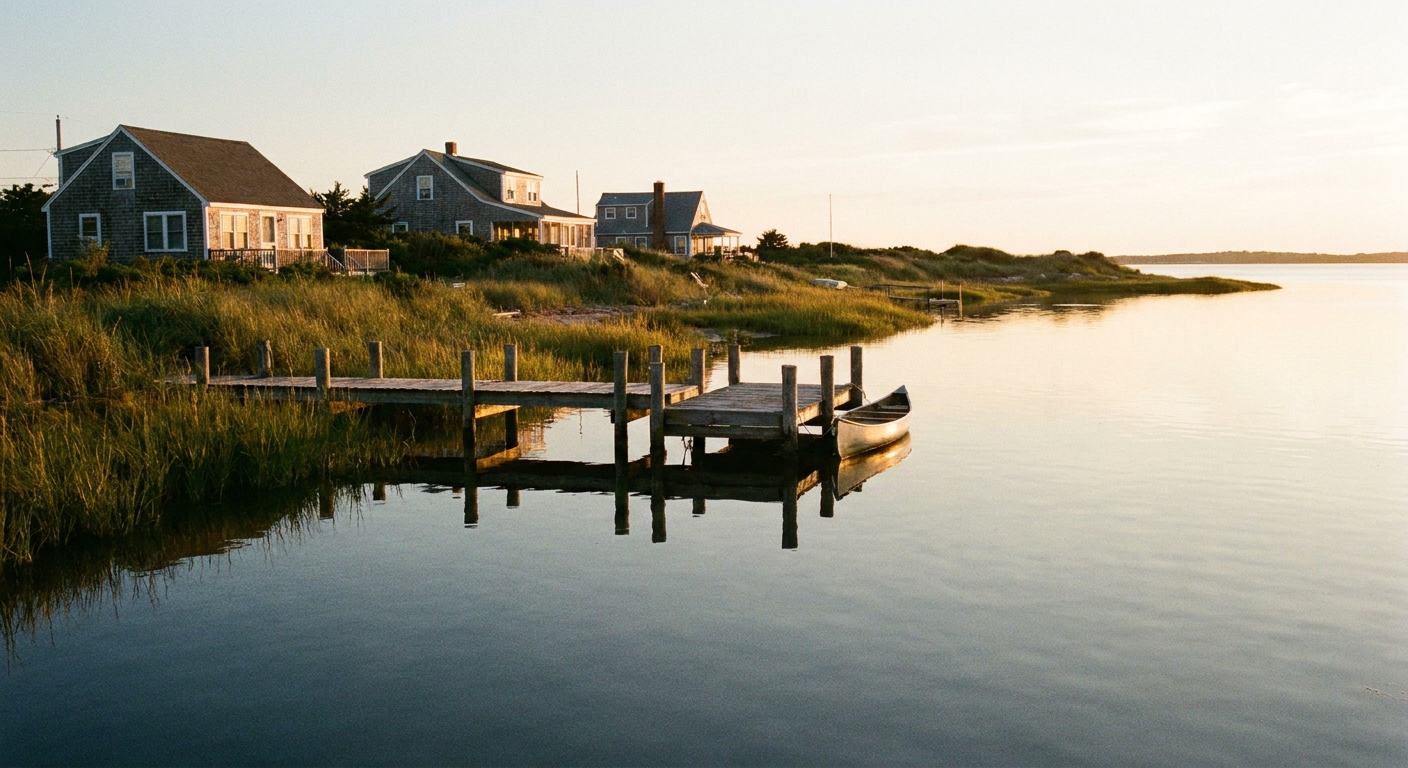
1) The bayfront, not the oceanfront
Busy beach towns often have a calmer water side: bays, inlets, marinas, river mouths. The oceanfront area may be the famous one, while the neighboring ZIP often includes:
- Benches, docks, and sunset views
- Kayak launches and fishing piers
- Low-key seafood shacks that close early because locals actually sleep
2) Walk-in beach access streets
The biggest lots fill first. The smaller access points are easier to miss, especially if you are driving straight toward the boardwalk. ZIP maps help you notice zones where streets dead-end into dunes or have modest public access markers nearby.
What to look for on the map:
- Short streets perpendicular to the beach with minimal commercial labels
- Neighborhood grids right behind the dunes
- Fewer parking icons nearby
3) Pocket parks locals use as a buffer
When I want a peaceful coffee break, I aim for a small park near but not on the main drag. ZIP boundaries often line up near a change from tourist-heavy blocks to neighborhood routines.
If you are traveling with kids or need a reset between activities, you can also use Kid-Friendly Parks by ZIP Code to pinpoint green space without guesswork.
4) Quiet cafés just beyond the souvenir zone
This is my favorite payoff. One corner has 17 neon dessert places. One boundary away, there is a bakery with mismatched mugs and someone’s grandma behind the counter.
Use this simple filter as you scan:
- Tourist core: lots of identical menus, late-night hours, big patio crowds
- Quiet pocket: fewer listings, earlier closing times, “coffee and pastry” type spots
To build a food-first plan, I use the same approach in Find Hidden Gem Restaurants With a ZIP Code, then I anchor it to a calmer shoreline access.
Parking tips with ZIP maps
In high-traffic waterfront towns, parking is half the battle. ZIP maps help because the edges of the tourist core often show up as edges on a ZIP boundary map too. That does not mean the boundary creates the rule, but it can point you to where the pattern changes.
Spot permit-heavy areas early
If you cross a boundary and suddenly see dense residential blocks near the beach, assume there may be resident permits or strict time limits. That does not mean “do not go.” It means “park carefully and read every sign.”
- Look for signed public lots near parks, marinas, or civic buildings
- Expect shorter time limits on street parking close to the sand
- Plan a short walk from a legal spot, especially on weekends
Reality check: ZIP vs jurisdiction
A ZIP boundary can be close to a real dividing line, but it can also slice straight through a city or a beach district. Parking enforcement might follow municipal limits, a state park boundary, a beach authority zone, or even one specific street. Treat the ZIP map as your scouting tool, then let posted signs and local rules be the boss.
Arrive in phases
My favorite day-out rhythm in a busy beach town looks like this:
- Early: park near the quiet pocket and do your calm beach walk or coffee first
- Midday: swing through the boardwalk zone for one or two “tourist classics”
- Late: return to the calmer side for sunset or dinner
When you structure the day this way, you avoid the worst parking crush and you still get the fun stuff.
A calm coastal micro-trip
If you want this to feel easy, not like a research project, here is a simple itinerary skeleton I use again and again.
Morning: quiet shoreline first
- Pick a beach access or bayfront spot near the edge of the busy ZIP or just across the boundary
- Walk 30 to 60 minutes with a “no agenda” rule
- Grab coffee in the calmer pocket before the boardwalk wakes up
Midday: boardwalk window
- Choose one anchor: a pier, a lighthouse view, an arcade, a classic snack
- Set a timer if you have to. Two hours is plenty for most people.
Afternoon: your ZIP detour
This is where I add a small “only here” moment:
- A historical marker loop using Find Historical Markers by ZIP Code
- A self-guided walk mapped by boundaries with Map a Self-Guided Walking Tour With ZIP Code Boundaries
- A local shopping stroll away from the boardwalk using Map a Support-Local Shopping Spree by ZIP Code
Evening: sunset on the less-hyped side
End the day where you began: on the calm edge. If the oceanfront is shoulder-to-shoulder at sunset, the bayfront often feels like you rented the whole sky.

Red flags to watch
I love a secluded-feeling spot, but I love not getting towed even more. A few practical cautions:
- Dunes are not shortcuts. Use marked access paths and respect fencing and vegetation.
- Private roads happen. Especially near waterfront communities and marinas.
- “Empty” lots can be employee or permit parking. If signs are unclear, choose another option.
- Watch tide and weather. Low-lying access points can become messy fast. If you want a tighter forecast by area, try Match Hyper-Local Weather to ZIP Codes.
Quick example from my own planning: I will pick a calm-looking edge street near a marina, then I confirm it two ways before I commit, I look at street-level images for permit signs, and I zoom in on the nearest public lot or park label. That tiny check saves me the “circling while everyone gets carsick” phase.
FAQ
Do ZIP boundaries match neighborhoods?
Not perfectly. ZIP codes are designed for mail delivery, not identity. But in coastal towns, they can still reveal real patterns: commercial clusters, residential stretches, and where the pace tends to shift.
What if the whole shoreline is one ZIP?
Then use the same method inside the ZIP: identify the magnet zone, then aim for the edges of that zone, especially where the street grid thins out or where the coastline changes from oceanfront to inlet or bayfront.
How do I skip tourist-trap restaurants?
Eat one iconic boardwalk thing on purpose, then do your real meal a boundary away. I map for smaller clusters, shorter operating hours, and streets that look more residential than souvenir-heavy.
Does this work with kids or a group?
Yes. The trick is to start calm while everyone has energy, then do the busy stuff midday, then finish calm again. Parks, easy walks, and bayfront sunsets make groups happier than trying to force serenity on a crowded promenade.
One last Leah tip
If you only remember one map hack, make it this: in a famous beach town, do not drive toward the most famous landmark first. Pull up the ZIP boundary, pick a calmer edge, and start your day there. You will still get the postcard moments, but you will also get the part that feels like you discovered it.
If you want more ways to build a day out that is not chained to one tourist strip, I keep my broader planning approach in Plan a Local Day Out Beyond a ZIP Code.